The catalpa-style house that my folks and I now reside in doesn't have a basement so looks like our interior windowless bathrooms or walk-in closets would be our best spots to go in the event of a tornado warning.
Currently 54 here in G'ville and progged for around 68 today.
February 2024 Weather Discussion
-
MVWxObserver
- Hurricane
- Posts: 5362
- Joined: Fri Feb 26, 2021 7:48 pm
- Location: Greenville, OH
-
Bgoney

- Tropical Storm
- Posts: 3594
- Joined: Fri Feb 26, 2021 7:09 pm
- Location: East clermont, 3mls north of Williamsburg
Re: February 2024 Weather Discussion
Past 24 hours record/near record temps
You do not have the required permissions to view the files attached to this post.
Proud owner of Best Guess Forecast Center (BGFC)
Former owner of Gut Feeling Forecast (GFF) and Doppler Infinity
I know just enough about weather to be dangerous!
Former owner of Gut Feeling Forecast (GFF) and Doppler Infinity
I know just enough about weather to be dangerous!
-
tron777

- Major Hurricane
- Posts: 19938
- Joined: Fri Feb 26, 2021 5:10 pm
- Location: Burlington, KY
- Contact:
Re: February 2024 Weather Discussion
Some of those record highs are all time monthly records for Feb and for Met. Winter too. How about this for a temp drop.... NWS has Springfield, ILL with a high of 80 today, and a low of 21 by tomorrow morning. Ouch! That is going to sting a little. 


Re: February 2024 Weather Discussion
This is rather concerning (echoing Trev's thoughts).....sigtor probs valid 06z or 1:00 am later tonight/early Wednesday.
You do not have the required permissions to view the files attached to this post.
Mike B.
Miamisburg, OH
The KING of the domes!

Miamisburg, OH
The KING of the domes!
-
tron777
- Major Hurricane
- Posts: 19938
- Joined: Fri Feb 26, 2021 5:10 pm
- Location: Burlington, KY
- Contact:
Re: February 2024 Weather Discussion
I hope I am wrong, but I like our NW forecast area as having the best chance with the threat decreasing as one works towards the SE. 12Z HRRR sounding still looks good for some spin up's though. The model has 2 lines. One for the I-70 Corridor in that 9pm to 12am window and for the Cincy Tri-state in that 12am to 2am window.
Can you (or anyone) post a 12Z NAM sounding please? Thanks!
-
Bgoney
- Tropical Storm
- Posts: 3594
- Joined: Fri Feb 26, 2021 7:09 pm
- Location: East clermont, 3mls north of Williamsburg
Re: February 2024 Weather Discussion
Hrrr with each new run keeps ramping up the chances
Proud owner of Best Guess Forecast Center (BGFC)
Former owner of Gut Feeling Forecast (GFF) and Doppler Infinity
I know just enough about weather to be dangerous!
Former owner of Gut Feeling Forecast (GFF) and Doppler Infinity
I know just enough about weather to be dangerous!
-
tron777
- Major Hurricane
- Posts: 19938
- Joined: Fri Feb 26, 2021 5:10 pm
- Location: Burlington, KY
- Contact:
Re: February 2024 Weather Discussion
12Z ILN Sounding is in from their morning weather balloon launch and you can clearly see a nice hail profile due to low freezing levels and also as Trev mentioned, the winds are backed at the surface in a southerly direction, then SW about 5000 feet up.
https://www.spc.noaa.gov/exper/soundings/24022712_OBS/
https://www.spc.noaa.gov/exper/soundings/24022712_OBS/
-
tron777
- Major Hurricane
- Posts: 19938
- Joined: Fri Feb 26, 2021 5:10 pm
- Location: Burlington, KY
- Contact:
Re: February 2024 Weather Discussion
The morning convection largely has missed us to the south and we have a pocket of sunshine over us now. Not sure if the clouds over SC IN will get in here or not. Better dews and moisture return is still off to our West ahead of the cold front over ILL, far Western IN, and Western KY.
-
tron777
- Major Hurricane
- Posts: 19938
- Joined: Fri Feb 26, 2021 5:10 pm
- Location: Burlington, KY
- Contact:
Re: February 2024 Weather Discussion
Dews have gone up in the last hour at CVG. 47 degree dew at 8am and it's now up to 53 as of the 9am reading. Lower levels of the atmosphere are beginning to saturate more now. We'll have to see how much instability we can get later on today. We would like to see at least 1000 J/kg minimum. Currently seeing 500-1000 J/Kg in that higher dew point area to our West that I just mentioned.
-
tron777
- Major Hurricane
- Posts: 19938
- Joined: Fri Feb 26, 2021 5:10 pm
- Location: Burlington, KY
- Contact:
Re: February 2024 Weather Discussion
Meanwhile on the NW side of this storm, an MD was just issued for blizzard like conditions for SE ND thru W MN and into Ontario as the day wears on.
https://www.spc.noaa.gov/products/md/md0160.html
https://www.spc.noaa.gov/products/md/md0160.html
-
BookNerdCarp

- EF0 Tornado
- Posts: 334
- Joined: Fri Feb 26, 2021 5:57 pm
-
tron777
- Major Hurricane
- Posts: 19938
- Joined: Fri Feb 26, 2021 5:10 pm
- Location: Burlington, KY
- Contact:
Re: February 2024 Weather Discussion
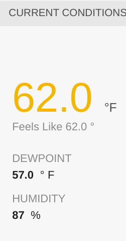
63 / 54 coming in at CVG.
Re: February 2024 Weather Discussion
Nice temp!
You do not have the required permissions to view the files attached to this post.
-
tron777
- Major Hurricane
- Posts: 19938
- Joined: Fri Feb 26, 2021 5:10 pm
- Location: Burlington, KY
- Contact:
Re: February 2024 Weather Discussion
Update from the boys:
.NEAR TERM /UNTIL 6 PM THIS EVENING/...
Convection, elevated in nature, continues to mostly push east
from our forecast area this morning. For later this morning into
the afternoon hours, pcpn chances for later today remain
somewhat uncertain. At this point, will continue to allow for
some lower chance pops to shift gradually north as a pseudo warm
front/instability boundary lifts north across our area. Some
weaker surface instabilities will likely develop through the
afternoon, which may allow for a bit more of a focus across our
northern areas later in the day. There is still a small window
for some better development of stronger storms near this
boundary late this afternoon into early evening across our far
northwest, but it looks like the better chance for this will be
off to our northwest, where the better surface based
instabilities should be as well at the nose of a developing low
level jet. It will continue to be breezy to locally windy with
unseasonably warm temperatures. Highs will range from the mid to
upper 60s.
&&
.SHORT TERM /6 PM THIS EVENING THROUGH 6 PM WEDNESDAY/...
The cold front will approach our area from the northwest
tonight, pushing into our far northwest toward daybreak.
Strengthening low and mid level flow ahead of the front will
lead to good moisture transport up into our area through the
night. This will allow for the axis of better surface based
instability to shift east into our area overnight, but it should
also be weakening slowly as it does.
There remains a fair amount of model differences with the exact
timing and storm evolution overnight, but it would seem the
most likely scenario will be for a consolidating line of storms
to move into our western areas after midnight tonight and then
move southeast across our area through the early morning hours.
With the strengthening wind fields, there will be a damaging
wind threat with these storms and it will also be tough to rule
out an isolated tornado. It still appears the best chance for
this would be across about the northwest half of our area, with
a decreasing chance heading to the southeast as we get further
into the early morning hours and the surface based instability
continues to decrease. Pcpn chances should then taper off fairly
quickly through Wednesday morning as the front moves through.
Re: February 2024 Weather Discussion
ALERT - SPC day 1 outlook now has SW Ohio and SE Indiana in Enhanced risk
10% hatched tornado probs from Cincy into southern Indiana.
10% hatched tornado probs from Cincy into southern Indiana.
Mike B.
Miamisburg, OH
The KING of the domes!
Miamisburg, OH
The KING of the domes!
Re: February 2024 Weather Discussion
SPC updated discussion:
...OH Valley...
A fast-moving southern-stream shortwave trough over the central
Plains will track eastward today and begin affecting parts of MO by
late afternoon or early evening. Most 12z guidance suggests that at
least isolated thunderstorm development will begin around/after dusk
as the large-scale forcing overspreads the northern extent of
moist/unstable air mass from southwest MO into southern IL. These
storms will intensify and track eastward overnight roughly along the
OH river, moving into parts of OH/WV/PA by early morning Wednesday.
Initial storms may be discrete, with sufficient vertical shear for
supercells structures capable of all severe hazards. As the night
progresses, activity will likely evolve into fast-moving bowing
structures with an enhanced risk of damaging wind gusts and a few
tornadoes. A strong tornado or two cannot be ruled out. Have added
an ENH risk area for this scenario overnight.
Mike B.
Miamisburg, OH
The KING of the domes!
Miamisburg, OH
The KING of the domes!
-
tron777
- Major Hurricane
- Posts: 19938
- Joined: Fri Feb 26, 2021 5:10 pm
- Location: Burlington, KY
- Contact:
Re: February 2024 Weather Discussion
Interesting developments for sure. The question is going to be when will the cap break? The sooner, the more intense the storms will be, The later it breaks, the more tame this event will be. That is an unknown and we'll have to wait and see what happens by the evening hours to get that question answered. A pretty capped environment to our West currently exists and is forecast to do so until after 5pm or so.
-
Bgoney
- Tropical Storm
- Posts: 3594
- Joined: Fri Feb 26, 2021 7:09 pm
- Location: East clermont, 3mls north of Williamsburg
Re: February 2024 Weather Discussion
You do not have the required permissions to view the files attached to this post.
Proud owner of Best Guess Forecast Center (BGFC)
Former owner of Gut Feeling Forecast (GFF) and Doppler Infinity
I know just enough about weather to be dangerous!
Former owner of Gut Feeling Forecast (GFF) and Doppler Infinity
I know just enough about weather to be dangerous!
-
tron777
- Major Hurricane
- Posts: 19938
- Joined: Fri Feb 26, 2021 5:10 pm
- Location: Burlington, KY
- Contact:
Re: February 2024 Weather Discussion
15Z HRRR does not show any super cells popping over IN until 10pm with those cells becoming a line to impact Cincy around 1am. We get a second round around 4am then the cold front passes shortly thereafter. Temps will start to plummet after the front passes tomorrow morning. Should see the 30s for the drive home with wind chills in the 20s.

Re: February 2024 Weather Discussion
That enhanced risk area is nearly identical to where I outlined the greater risk early this morning.
You do not have the required permissions to view the files attached to this post.
Re: February 2024 Weather Discussion
Great Post Les and like you mentioned we won't know the exact capped environment until later today. Brian did a great job breaking down everything and like he mentioned some things are set and that is we will see some severe weather but how strong is something we must wait to see how things shape up. What we want to see is more clouds throughout the day and this includes well to the west of us. If we start to see the clouds erode say in the 1-4pm time period then it most likely means the severe potential will go up.tron777 wrote: ↑Tue Feb 27, 2024 11:40 am Interesting developments for sure. The question is going to be when will the cap break? The sooner, the more intense the storms will be, The later it breaks, the more tame this event will be. That is an unknown and we'll have to wait and see what happens by the evening hours to get that question answered. A pretty capped environment to our West currently exists and is forecast to do so until after 5pm or so.
He made a wonderful point about how sometimes you get two areas of severe weather and they are several miles away but they can feed into each other and especially the southern most area that can enhance severe weather and yes tornado's. Going to be busy later today and sure many folks will be on the forum this evening.
-
Bgoney
- Tropical Storm
- Posts: 3594
- Joined: Fri Feb 26, 2021 7:09 pm
- Location: East clermont, 3mls north of Williamsburg
Re: February 2024 Weather Discussion
Good old fashion dry line with about a 30 degree DP difference in only a few miles
You do not have the required permissions to view the files attached to this post.
Proud owner of Best Guess Forecast Center (BGFC)
Former owner of Gut Feeling Forecast (GFF) and Doppler Infinity
I know just enough about weather to be dangerous!
Former owner of Gut Feeling Forecast (GFF) and Doppler Infinity
I know just enough about weather to be dangerous!
Re: February 2024 Weather Discussion
That is one way to have an elevated threat of tornado's. We see this all the time in the western plains with dry air getting involved but less so around this part of the world.
-
tron777
- Major Hurricane
- Posts: 19938
- Joined: Fri Feb 26, 2021 5:10 pm
- Location: Burlington, KY
- Contact:
Re: February 2024 Weather Discussion
One thing is for sure.... the radar won't be showing much until after dark. Then it's just a question of when the cap breaks and how much CAPE we have left from the daytime hours. This is definitely a conditional threat with high bust potential IMO. I understand why the SPC upgraded us and it's not a bad idea to raise public awareness since this will be an overnight event when most folks are asleep.
